太平山
With the elevation of 552m, Victoria Peak is the highest hill on Hong Kong Island, it is also known as the "Censer Peak". “Censer Peak" originated from the name "Red Censer", it was first seen in the coastal map in the Sea Country Record (“海國聞見錄”) in 1744, which marked Hong Kong Island as "Mount Red Censer". The name "Red Censer" also appeared in the chart of the Xin’an County Gazetteer (“新安縣志”) in 1819, which was believed to indicate the location of the flood station (the location where troops were stationed) on Hong Kong Island at that time. Therefore, Victoria Peak, the highest peak on the island, was called “Censer Peak". (Note: Nowadays, “Red Incense Burner Summit" is also referred to as a 220m tall hill at the southwest of Braemar Hill in North Point).
In the early days of British occupation of Hong Kong Island, Victoria Peak was named Mount Possession. Since the British once hoisted the British flag at the peak, it was also called “Mount Flag-raising"; later on, it was renamed after Queen Victoria as Victoria Peak. The locals called Victoria Peak "Mount Flag-hoisting", as it is generally believed that before the telegraph era in the early 19th century, the observatory staff at the peak would hoist a flag when they saw the sea-going vessel to notify the navigators at the bottom of the hill. At present, the locals mainly refer to Victoria Peak as "The Peak".
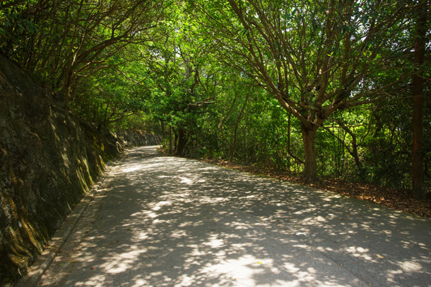
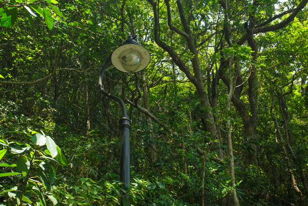
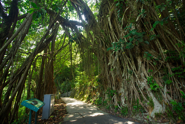
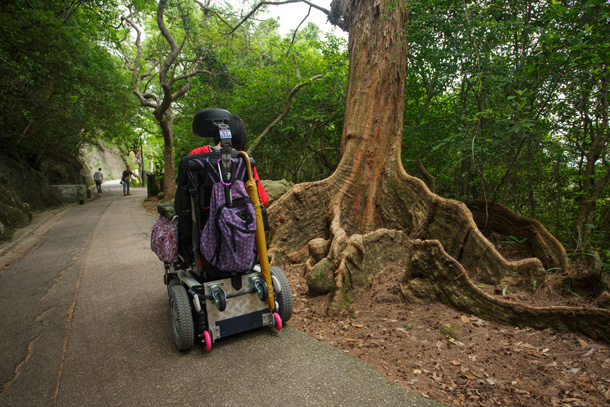
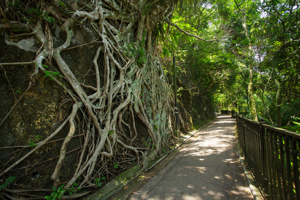
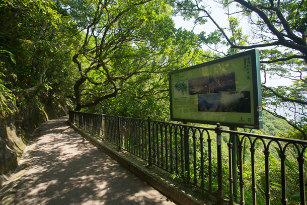
There is a walking trail called Lugard Road at about 400m near The Peak, it was built between 1913 and 1914, and named after the 14th Governor of Hong Kong, Sir Frederick Lugard. The walking trail was built on the rock surface of the northern slope of Victoria Peak, with a total length of about 2,400m. The construction was quite massive at that time, rocks were chiselled to hold up the plank road, electric lights and concrete seats were built at the same time, some of the concrete seats still exist today.
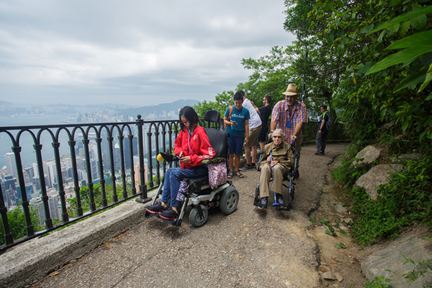
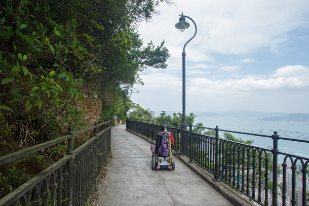
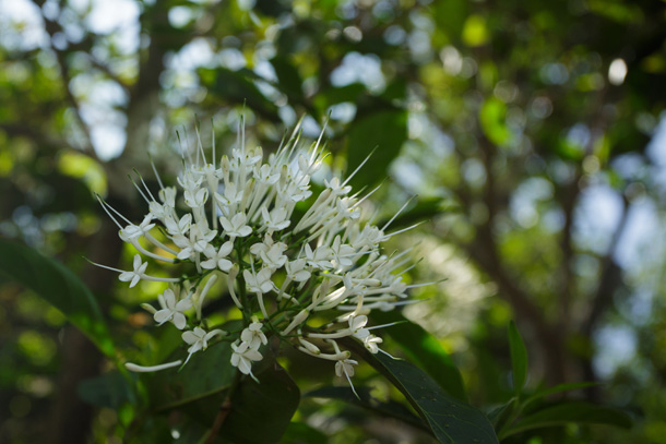
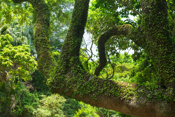
If tourists want to visit Victoria Peak on foot, they can start from The Peak Tower and loop around Victoria Peak via Lugard Road and Harlech Road. The first part of the trail runs parallel to Hong Kong Trail Section 1, some other parts are the same as Pok Fu Lam Tree Walk and the Peak Trail. There are sufficient barrier-free facilities and interpretive signages to introduce the animals and plants along the route, as well as the history of The Peak.
| The Peak Tower | Lugard Road | High West Picnic Area | Harlech Road | The Peak Tower | ||||
Start from The Peak Tower, walk along Lugard Road to High West Picnic Area, then turn left to Harlech Road (the trails on the right are Hatton Road and Section 1 of Hong KongTrail) and return to The Peak Tower.
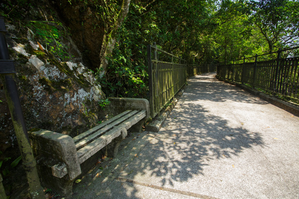
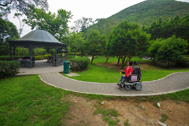
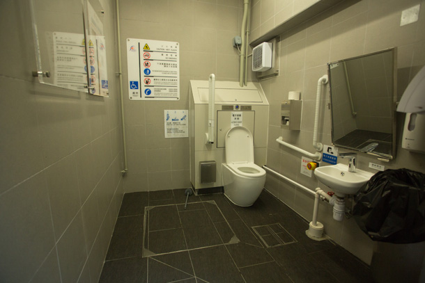
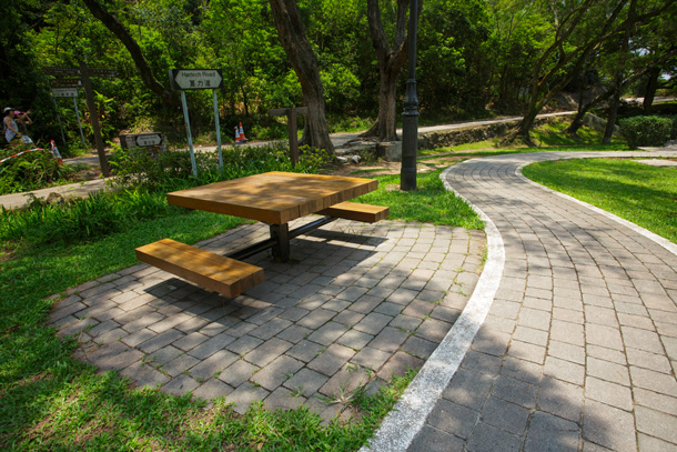
Accessible toilet, interpretive signage, pavilion and picnic table
| Starting point | ||
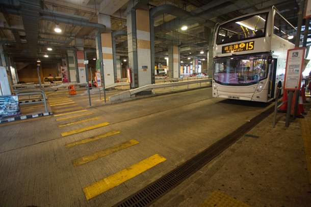
| Bus No. 15 |
Central Ferry Piers - The Peak (Get off at The Peak terminal) |
- |
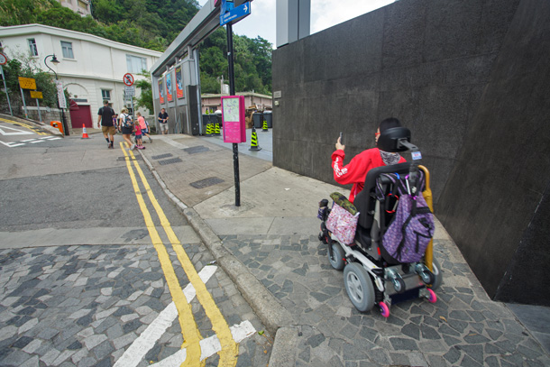
| (Note: If you travel by MTR, you can take the lift from the side of Exit A (Connaught Road Central) of Central Station to Exit G (World-Wide House), then take the lift on the opposite side to connect to the flyover, cross Connaught Road Central and turn left to Exchange Square Block 3, then take the lift down to Harbour View Street and head to the bus stop) | ||
| Peak Tram | Peak Tram Central Terminus - The Peak (Get off at The Peak) |
10 min |
| (Note: For details of the tram ride for wheelchair users, please refer to the remarks at the bottom of this page) | ||
| Endpoint | ||
| Same as the above | ||
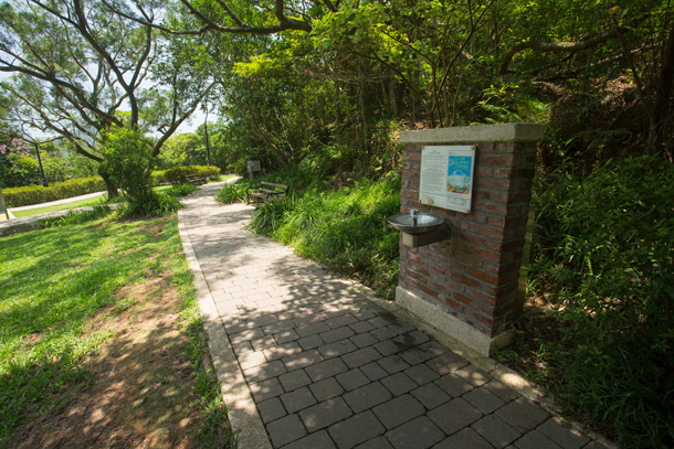
Water dispenser is available at High West Picnic Area
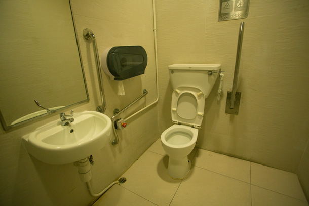
To access the toilet on Hatton Road, visitor has to descend a gentle slope of about 11° (1:5), wheelchair users are advised to be assisted by a companion.
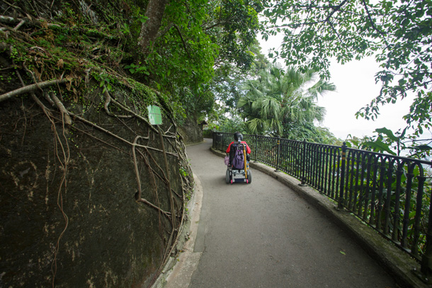
Samantha, an electric wheelchair user:Lugard Road on The Peak is a barrier-free hiking trail. The most impressive thing is that it is mainly a flat road along the way, I can appreciate different types of plants and breathe fresh air, and the accessible toilet is spacious. This place is worth hiking for friends with wheelchairs!
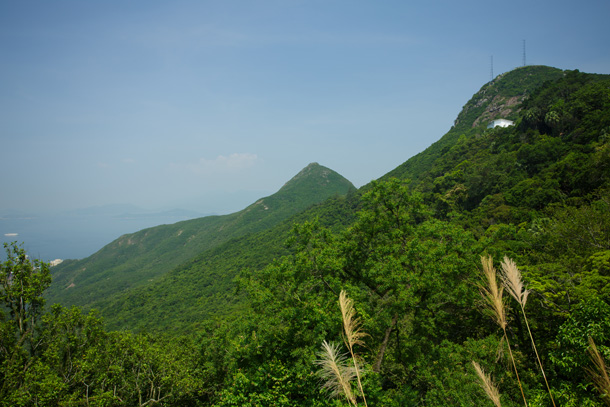
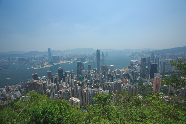
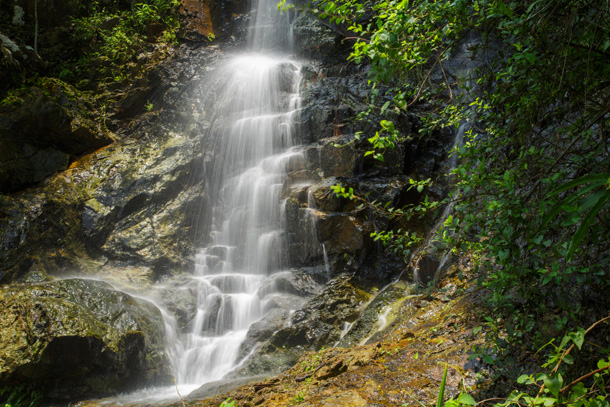
This loop trail is flat and has plenty of accessible facilities. In addition to the urban scenery of Victoria Harbour, visitors can also appreciate the local animals and plants, as well as the historical buildings of about 100 years old. It is a barrier-free route that combines scenic, ecological and historical features.
Lugard Road on The Peak has always been the first choice of barrier-free routes. Whether it is about the transportation, road surface, facilities, or distance, all factors suit the needs of wheelchair users. As the weather gets hotter in June, the shaded loop trail on The Peak is a good trial choice.
Every time I pass by this path, I notice some slight changes in the facilities. I still remember wheelchairs could not enter High West Picnic Area (located at the junction of Lugard Road and Harlech Road) in the past, but now there is a barrier-free passage, and wheelchairs can be positioned close to the picnic table. However, there are still some observation decks and fitness areas where barrier-free passage is not available, the position and design of some interpretive signage are difficult for wheelchair users to read, which needs to be improved.
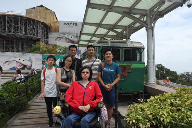
We invited Samantha and Margie to join the hike that day. Samantha once participated in the Tai Tam Reservoir hiking activity organized by Association of Women With Disabilities Hong Kong, she had hiked around Shing Mun Reservoir and Lion Rock when she was in better physical condition! Margie was a new acquaintance, we planned to try the route with her wheelchair user friend, but it was put on hold due to scheduling issue. I hope this experience could boost her confidence in hiking with her friends in the countryside in future.
The following information was provided by the Peak Tram (please contact the Peak Tram on 2522 0922 for any question):
Each tram ride can only carry one wheelchair user. The wheelchair restrictions for entering the tram are as follows: the width of manual wheelchair cannot exceed 26 inches/66 cm; the weight of electric wheelchair (together with the user) cannot exceed 300 lbs/136 kg and the width cannot exceed 26 inches/66 cm. If the electric wheelchair exceeds the above weight, a spare manual wheelchair can be borrowed from the Peak Tram.
The tram doors are equipped with steps, station staff will use mobile ramp to assist wheelchair user to get on and off the tram. Also, in order to ensure safety, the lithium battery of the electric wheelchair must be removed and hand-carried by the passenger.
- 丁新豹:〈紅香爐與紅香爐天后廟〉。香港歷史博物館。1999
- 漁農自然護理署,中西區區議會:盧吉道解說牌。2018
- 蕭曉華:〈在盧吉道散步(三):考據 盧吉道是如何建成的?〉。明報周刊。2016